Snake Den is a rather large state park — about 1,000 acres if you count the adjacent farms. Wikipedia says that Snake Den has “limited recreational opportunities.” The state website has only a rudimentary trail map, the parking areas are rough, and some trails are scarred by the deep ruts of ATVs. Ken Weber doesn’t mention Snake Den in his books on RhodeIsland trails.
But Snake Den has the best canyon/chasm that I’ve seen in Rhode Island, and some interesting quarry sites. I suggest using AllTrails, or the map at the parking area.
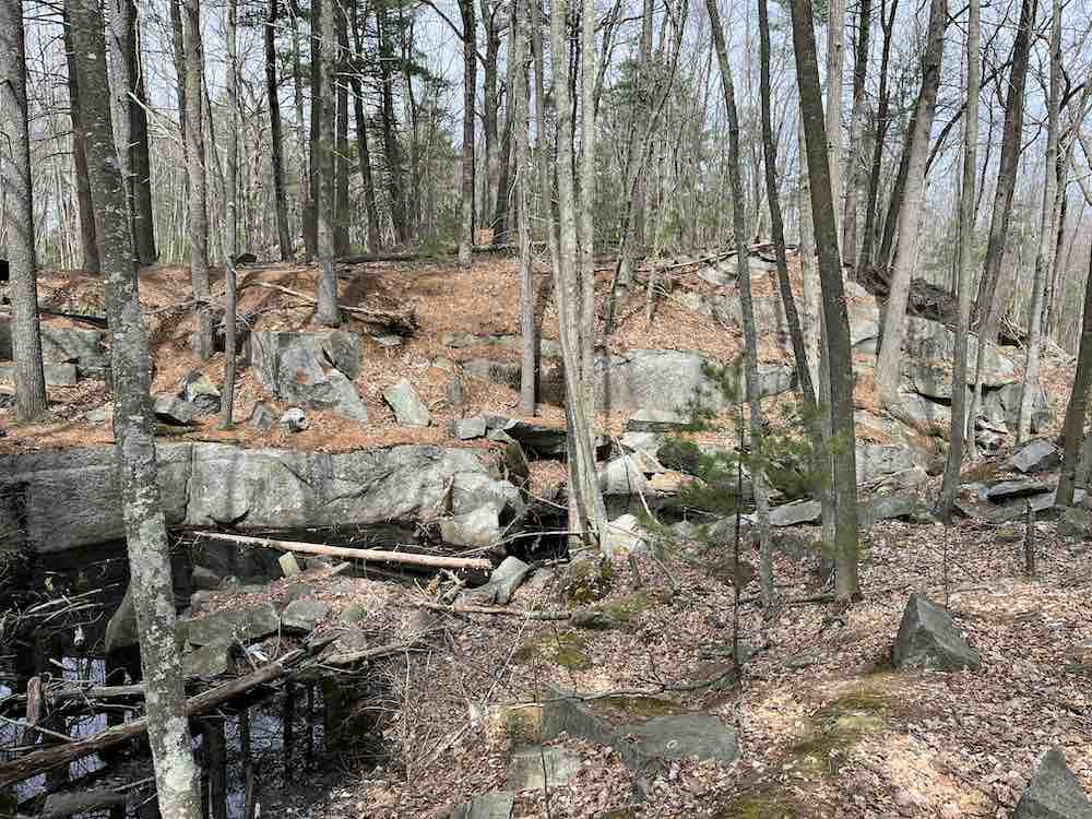
Stone from the SnakeDen quarry was “used in the building of the First Congregational Church in Providence, better known as the First Unitarian Church, designed by John Holden Greene, one of the BenefitStreet landmarks on historic College Hill. The nearby quarry of Bear Ledge [or Bare Ledge] provided the incredible columns for the Providence Arcade of 1828” (more info here).
The route below is two miles. I put a pin on a large outcrop (location approximate); there are a couple of erratic boulders on top of this outcrop, and more erratics are scattered through the park. I also put a pin where some quarrying was done, but quarrying wasn’t limited to one spot. You’ll recognize the quarries because the rock doesn’t look natural, it looks cut, and some of the rocks have drill marks. Since quarrying was often done below the surface of the land, it resulted in holes, which later filled with water.
I parked along Brown Avenue, which is probably named for Moses Brown, whose family played such a prominent role in early Providence. Moses owned farmland in the SnakeDen area, and derived rental income from it. As you drive along Brown Ave., you’ll pass small historic cemeteries in the farm fields, cemeteries for families like Brown, Waterman, Steere, and Dame.
Below is a SnakeDen quarry with a hole that has filled with water.
Below is a 2.5-mile route, starting from a different parking area. The canyon/chasm is only about a quarter-mile from the parking area.
When I first saw the cliffs, I thought I was in a scene from The Last of the Mohicans. Later I saw a hawk gliding over the cliff, and I thought I was in a painting by the Hudson River School. I find that a photo doesn’t do justice to the size of the cliffs, perhaps you need to station a person at the base of the cliff, for scale.
What created the canyon and the cliffs? A roaring river? A fault/crack/drop of the lower land, of the valley between the cliffs?
When you take the above route, you can glimpse a cliff to the east after about half-mile, but you can’t see it clearly. The route below gives you a better view of the “eastern cliff;” it goes along the base of the cliff. It reaches an overhang/ledge, which is probably what the parking-lot map calls the “Hidden Prehistoric Shelter.” From this trail, there’s no connection to the main trail, so you may want to turn back and retrace your steps to reach the main trail.
The route below goes further east, along the top of the cliff — except near the parking lot, where it goes along the bottom of the “canyon.”
Since the above route is on the top of the cliff, you don’t get a good view of the cliff. At a couple points, however, you can get a glimpse of the cliff. One of these glimpses is of the overhang/ledge that I mentioned previously.
The Rhode Island Natural History Survey found over 1,000 species at Snake Den in a 24-hour period in 2017.
Below is a map of Snake Den, showing where hunting is allowed.
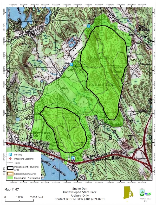
Click here for the original, pdf version of the above map.
A website called Only In Your State has mapped a 20-mile SnakeDen drive that explores the countryside near Snake Den, starting in Branch Village, then passing through Forestdale, Slatersville, and Nasonville, before reaching Route 44 and the village of Chepachet. Then it follows Route 44 east to Snake Den. The map below gives you an idea of the route, though the route-recording starts a bit late, and ends a bit early, hence it’s only 14 miles.