We’re curious about the far-away, and overlook what’s under our nose. Though I’ve lived in the Providence area for 15 years, I haven’t explored Providence much. Finally I took a walking tour of Providence, organized by the Rhode Island Historical Society. It was a good tour; I recommend that you contact the Society if you want to explore Providence.
Our guide said that, like Boston, Providence was a port city, with access to the sea and to rivers. Like Boston, Providence had low-lying, swampy areas where you couldn’t construct a big building without paying special attention to the foundation.
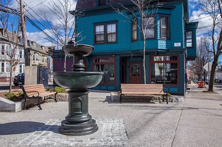
A walk on Benefit Street is a walk in the footsteps of Poe and Lovecraft, and has perhaps the best architecture in the U.S. If you start on the south end of Benefit Street, and walk one mile north, you’ll get to Hallworth House (a nursing home at 66 Benefit Street), which has a garden/patio/cemetery on its south side (left side). If you walk through this garden/patio/cemetery, you’ll be on North Main Street, then you can turn left (south) on North Main, which will become South Main. Stay on South Main for about .75 miles, then turn left on Williams Street, which will bring you back to Benefit Street. You’ll pass old houses, churches, government buildings, commercial buildings, apartment blocks, museums, libraries — a remarkable variety of architecture.
Poe often walked on Benefit Street. He visited the poet Sarah Helen Whitman, who lived at 88 Benefit Street; Poe and Whitman were briefly engaged in 1848. When Whitman learned that Poe had been drinking, she broke off the engagement. After Poe’s death, however, Whitman defended him in a book called Edgar Allan Poe and His Critics.
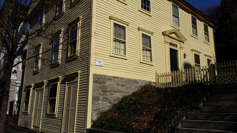
When Poe was in Providence, he stayed at The Mansion House, which was demolished in 1941. It was on Benefit Street, between 163 Benefit and 155 Benefit (now an empty space). The Mansion House was formerly called The Golden Ball Tavern, and hosted George Washington in 1790, and John Adams in 1797. Here’s what Lovecraft says in “The Shunned House”:
| Poe generally stopped at the Mansion House in Benefit Street — the renamed Golden Ball Inn whose roof has sheltered Washington, Jefferson, and Lafayette — and his favorite walk led northward along the same street to Mrs. Whitman’s home and the neighboring hillside churchyard of St. John’s, whose hidden expanse of eighteenth-century gravestones had for him a peculiar fascination. |
In the 1930s, the Federal Writers’ Project published a guide to Rhode Island. At that time, the Mansion House was still standing, and had taken back its old name:
| The Golden Ball Inn, 159 Benefit Street, was erected by Frank Rice in 1784. A very large structure for its time, it is four-and-a-half stories in height.... Known at various times as the Daggett Tavern, Mansion House, and Roger Williams House, it was for many years a social center of the town. Among distinguished guests at dinners and balls held here were Washington, John Adams, Jefferson, Lafayette, Monroe, Madison, and James Russell Lowell. (Rhode Island: A Guide to the Smallest State) |
The house that’s featured in Lovecraft’s “Shunned House” is at
135 Benefit Street, and was built about 1763.
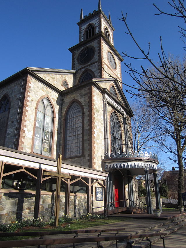
Cathedral of St. John (Episcopal), designed by John Holden Greene, built 1811
271 North Main Street, Gothic/Federal style
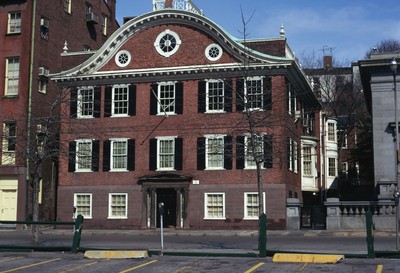 Joseph Brown House, 50 South Main Street, Georgian style, built in 1774 as a residence, then became The Providence Bank in 1791, one of the oldest banks in the U.S. It has a double-curved or ogee pediment and was designed by Joseph Brown, who designed many notable buildings in the area, including the John Brown House (52 Power Street) and University Hall at Brown University. |
The Rhode Island Historical Society is based in the John Brown House. They sell a small pamphlet called “Benefit Street: A Mile of History”; it’s a good source of architectural information. They also sell pamphlets on Downtown Providence, the West Side (Broadway), etc. One of the authors of their BenefitStreet pamphlet is William McKenzie Woodward, who wrote Guide to Providence Architecture. Woodward also had a hand in a book called Buildings of Rhode Island, which was produced by the Society of Architectural Historians, part of a series called “Buildings of the United States.” Arcadia Publishing issues books on many American towns; their books are rich in pictures, but poor in text. They call these books “Images of America.” One of their titles is Providence’s Benefit Street.
|
India Point Park (A) is near the junction of the Seekonk River and the Providence River. At this junction, the Seekonk River gives up its name (as many women do when they get married), and is thenceforth known as the Providence River. The Providence River flows south for about 7 miles to ConimicutPoint-NayattPoint (B), where it enters Narragansett Bay. So ConimicutPoint-NayattPoint might be called the gate of the Providence River. (Conimicut Point is on the west, in Warwick, while Nayatt Point is on the east, in Barrington.) India Point Park has walking paths and historic markers. For most of its length, the Seekonk River is known as the Blackstone River. |
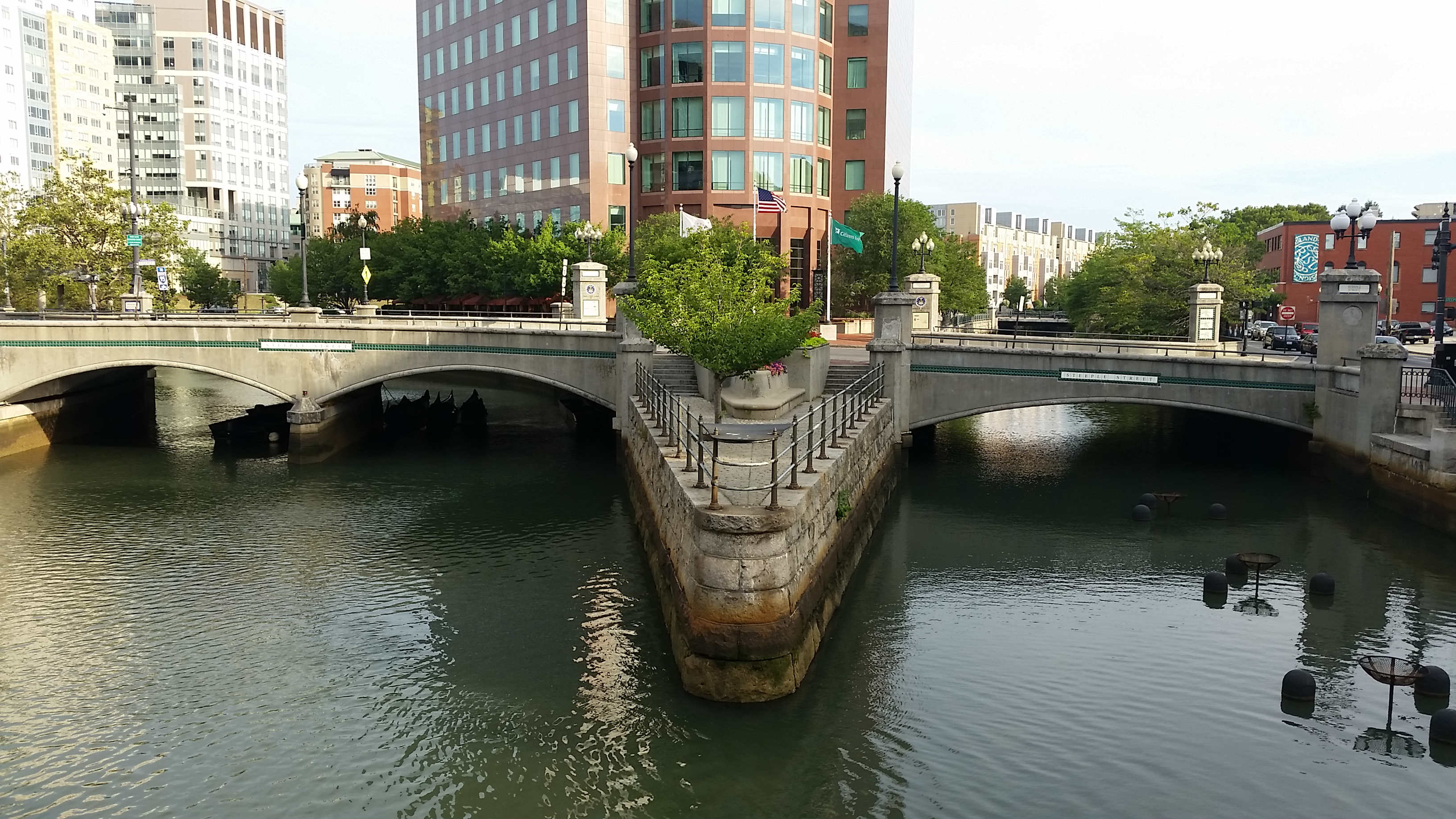 |
| The meeting of the Moshassuck River (right) and the Woonasquatucket River (left) in downtown Providence, between Steeple Street and Washington Street. The meeting of these rivers creates the Providence River, which flows south for about one mile, and meets the Seekonk River at India Point. |
|
Here’s a 3.5-mile walk that starts on Benefit Street, in Providence’s “old city,” then goes along the Providence River, then through the financial district, then follows Westminster Street to the Cathedral of Saints Peter and Paul, then crosses the highway and passes some creative examples of urban revival. After reaching Luongo Square, the route turns back toward the east. On the return route (the eastward route), I probably should have turned right on Empire Street, instead of Eddy Street.
Luongo Square |
Among my favorite places to walk in the Providence area are the EastBay BikePath, Caratunk (an Audubon refuge) and Swan Point Cemetery. If you’re studying trees, Swan Point Cemetery is the place for you; it has a variety of species, and many are labelled. (In 1848, Poe proposed marriage to Sarah Helen Whitman in Swan Point Cemetery.) Blackstone Boulevard has a 1.75-mile path down its center; the landscaping is good, the trees are interesting.
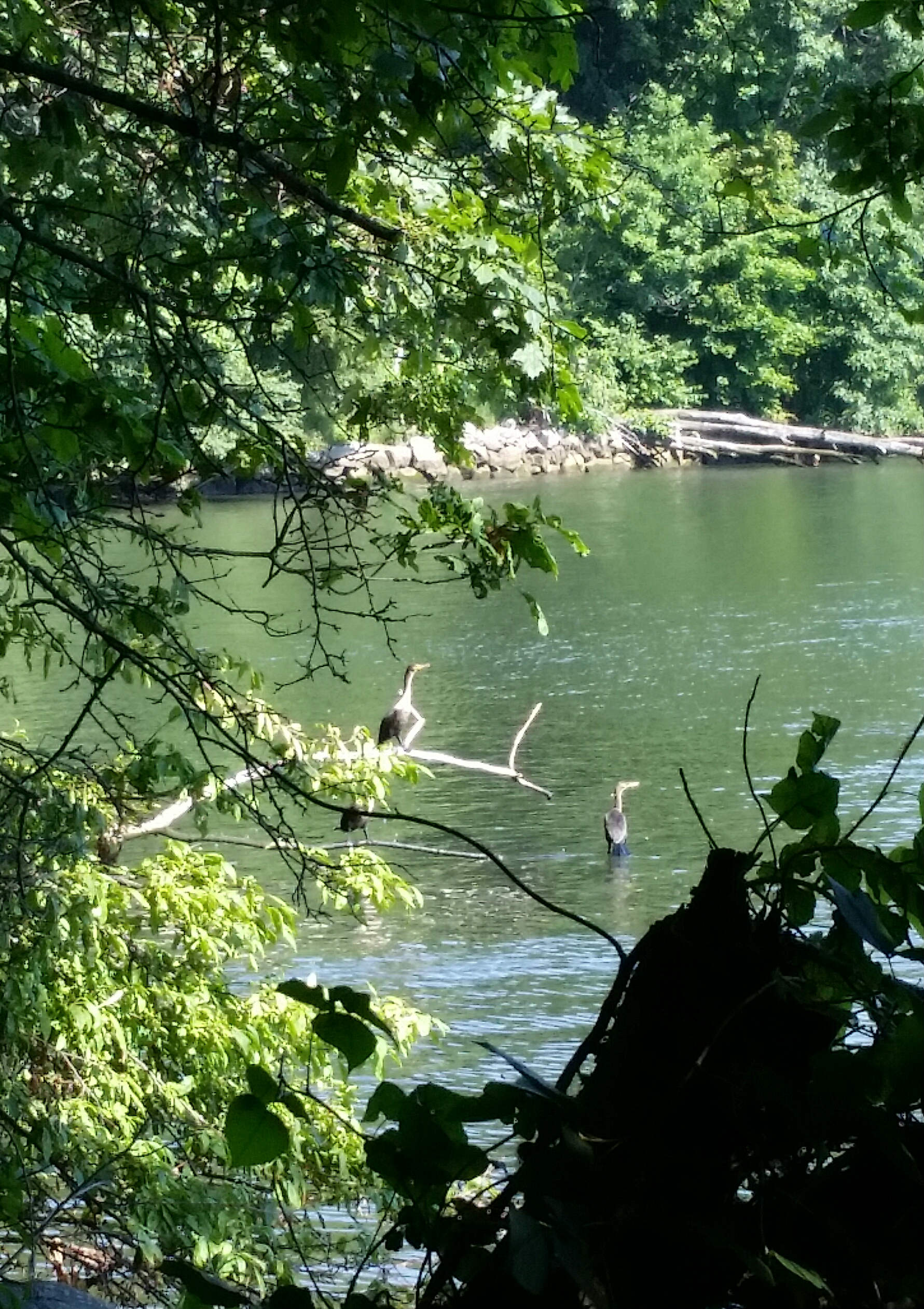 |
| You can see a variety of waterbirds if you take the river-trail at Swan Point Cemetery. |
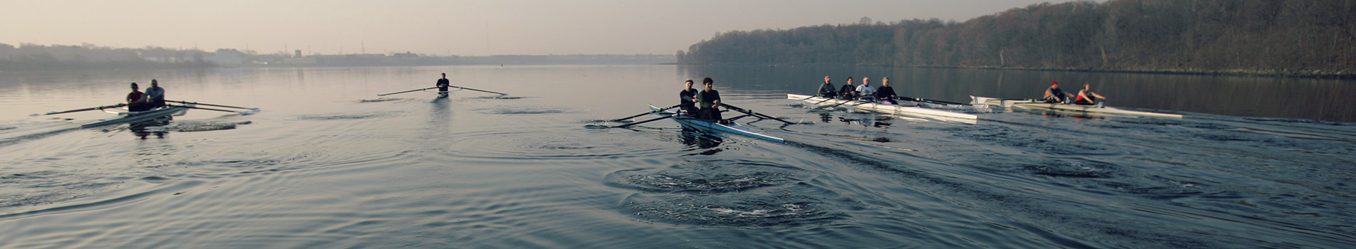
Below is a 3-mile route through Swan Point Cemetery. This route also goes through another cemetery, Riverside Cemetery, which is just north of Swan Point. Riverside isn’t as well-maintained as Swan Point, so you may want to stay in Swan Point. This route follows a trail along the river; the trail is sometimes muddy, and is strewn with downed trees and garbage, so you may want to skip it, though it has the potential to be one of the nicest trails in Providence. The trail goes along the Seekonk River for about one mile. You may see crew teams rowing on the river.
On the west side of Providence is a park called Neutaconkanut Hill. The hill is the highest point in Providence (296 feet), and affords the best view of downtown Providence. During the Depression, the WPA built a sidewalk leading to the top of the hill; this sidewalk is still in good shape. Below is a route that follows this sidewalk to the top, then takes a somewhat different path back to the parking lot.
At the top of the hill was a large erratic boulder, used by Roger Williams and the Native Americans as the boundary of Providence. About 300 years later, the boulder was destroyed to assuage the fears of those who lived at the base of the hill. I found a few Indian stone-structures at Neutaconkanut Hill, but not many. The hill once had a ski slope.
An article in the Providence Journal, written by John Kostrzewa, says that Thoreau’s only visit to Providence took place in December 1854; he came to deliver a lecture, and his visit included a hike to the top of Neutaconkanut Hill. Thoreau’s Journal for December 7 says he “Walked through Olneyville in Johnston, two and a half or three miles west of Providence” (Providence was smaller then). Since he doesn’t mention Neutaconkanut Hill, it probably didn’t make a strong impression on him. Lovecraft mentions this hill, if I remember correctly.
The New York Times website has a good piece on Providence. The National Park Service has a pamphlet about a walking tour of Providence churches, most of which are east of the downtown area. Also of interest is the website of the Providence Preservation Society, and the website of Preserve Rhode Island. Providence’s Independence Trail is marked with a green line; it was inspired by Boston’s Freedom Trail, which is marked with a red line (other walking tours of Providence can be found here and here).
The Rhode Island State House, located in Providence, offers a brochure with a self-guided tour. The State House library is decorated with 16 Printers’ Marks, like the dolphin logo of Aldus Manutius.
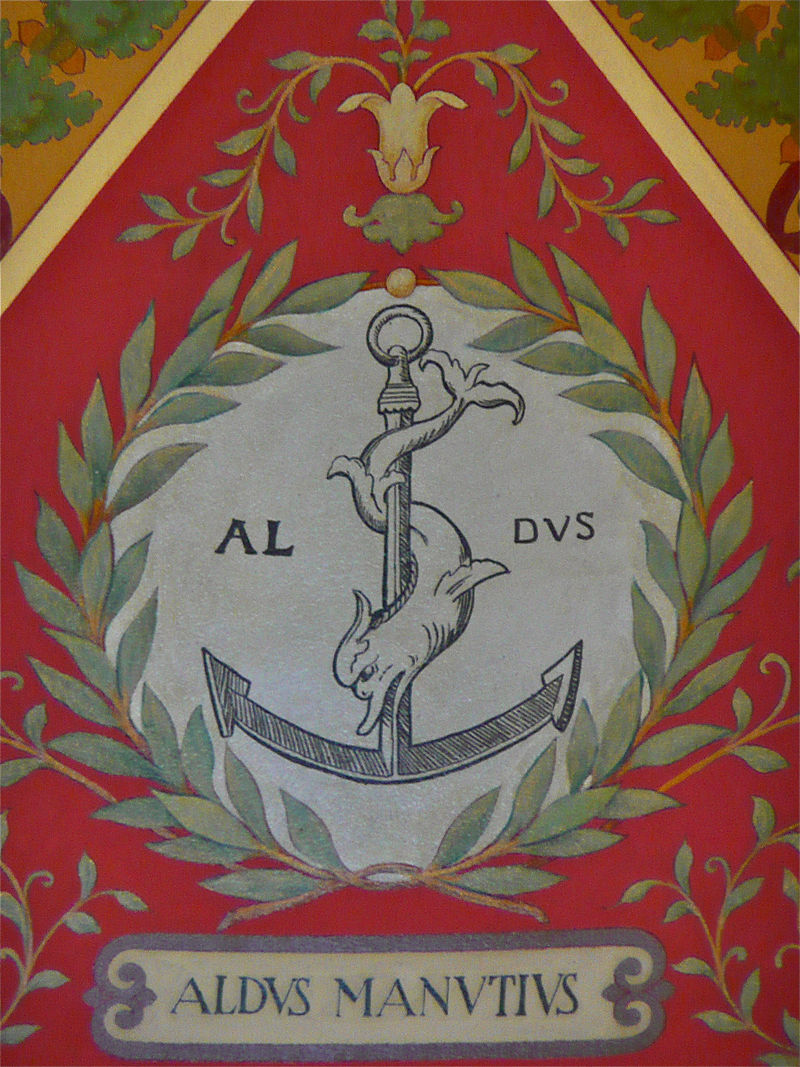
Logo of Aldine Press in Venice, the press started by Aldus Manutius. The dolphin-and-anchor image is taken from Roman coins. The dolphin symbolizes speed, the anchor stability; together they represent festina lente (make haste slowly). Other printers, like Doubleday, have also used the dolphin-and-anchor as their logo. Other book-related buildings are also decorated with Printers’ Marks. The image above is from the Library of Congress (Thomas Jefferson Building). |
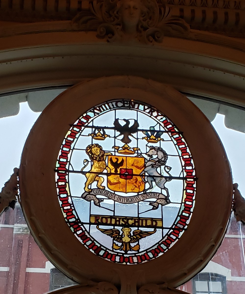
A Providence restaurant called The Dorrance, on the corner of Westminster Street and Dorrance Street, is adorned with the coats-of-arms of historic banks. Below is the Rothschild coat-of-arms, with the motto “Concordia, Integritas, Industria” (Integritas is spelled “Intergritas”)
The Dorrance was originally built as a bank. Above the entrance is a sculpture by Daniel Chester French, “The Puritan and the Indian.”
|
Here’s a 1.25-mile section of the EastBay BikePath (2.5 miles round-trip). It offers a good view of the bay/river, and a variety of waterfowl. The beginning of this walk (northern end) has a parking lot, the end has a bench. The bench is near the Boyden Heights Conservation Area, which offers parking. |
Late October, one of the coves along the EastBay Bikepath
(northern section). If you zoom in, you can see a heron fishing.
|
This route is 2.5 miles long (5 miles round-trip). It begins at the BoydenHeights parking lot, and soon reaches the EastBay BikePath. Then it passes a dock for big tankers, and the Pomham Rocks Lighthouse. Then it reaches Riverside Square, before leaving the BikePath, and going to Little Neck Cemetery, one of Rhode Island’s oldest cemeteries. |
|
Blackstone Park is near Blackstone Boulevard, and near the Blackstone River. The above route is about 2 miles. It has woodsy trails, quiet streets with sidewalks, and good views of the river. The above route passes the Narragansett Boat Club, a rowing club founded in 1838 (pic below).
|
|
Barrington Beach is a nice walk, with good views of Narragansett Bay. You can park at the beach, except in the summer. This walk doesn’t stay along the water because a stream bisects the beach, so I go off the beach to get around the stream. This walk is 1.5 miles (3 miles round-trip). At low tide, you can cross the stream, and take a long beach walk. |
|
This 1-mile loop is a nice blend of wood, field, and beach, and has a good view of Hundred Acre Cove. Nockum Hill is also known as the Doug Rayner Wildlife Refuge. It’s a historic area, and you’ll notice an old house nearby, and a large stone with an inscription. |
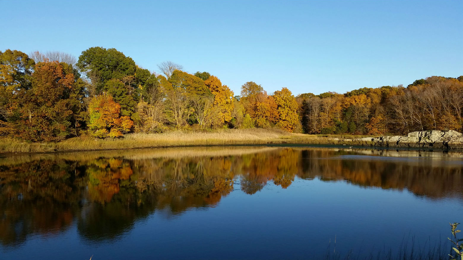
Hundred Acre Cove from Nockum Hill
|
Roger Williams Park in Providence is an old-fashioned city park, with classical architecture and elegant landscaping. The park has a zoo, a natural-history museum, a botanical center, etc. Guided tours are offered by the Park Conservancy. This route is 4 miles long. |
The John H. Chafee National Wildlife Refuge (also known as Rome Point) is a popular area for walking, offering good views of Narragansett Bay, and even a view of seals resting on offshore rocks.