Parker Woodland is a large Audubon refuge (860 acres) with an abundance of Indian stones, the remains of an old mill, the foundations of old houses, and interesting cliffs (trail map here). Some visitors may feel, however, that the trails are too rough and dark; if you want open skies and fields, Parker isn’t a good choice. Parker is about 12 miles west of Providence, and straddles the border of Coventry and Foster.
Just west of Parker Woodland is the Isaac Bowen House, a well-maintained historic house that has its own Wikipedia page. It’s owned by the Audubon Society; the ParkerWoodland caretaker lives in it. It has the same address as the refuge: 1670 Maple Valley Road, Coventry RI.
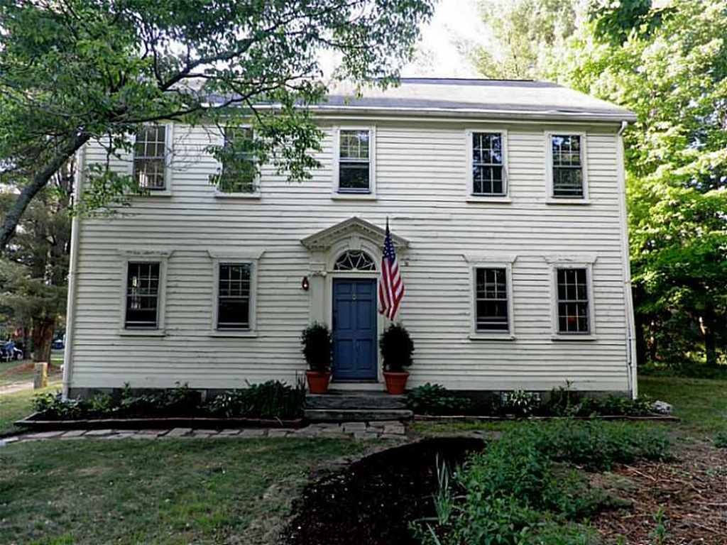
Isaac Bowen House
Below is a 3.5-mile route in the Coventry section (the southwestern section) of Parker Woodland. This route is similar to the route in Ken Weber’s Walks and Rambles in Rhode Island.
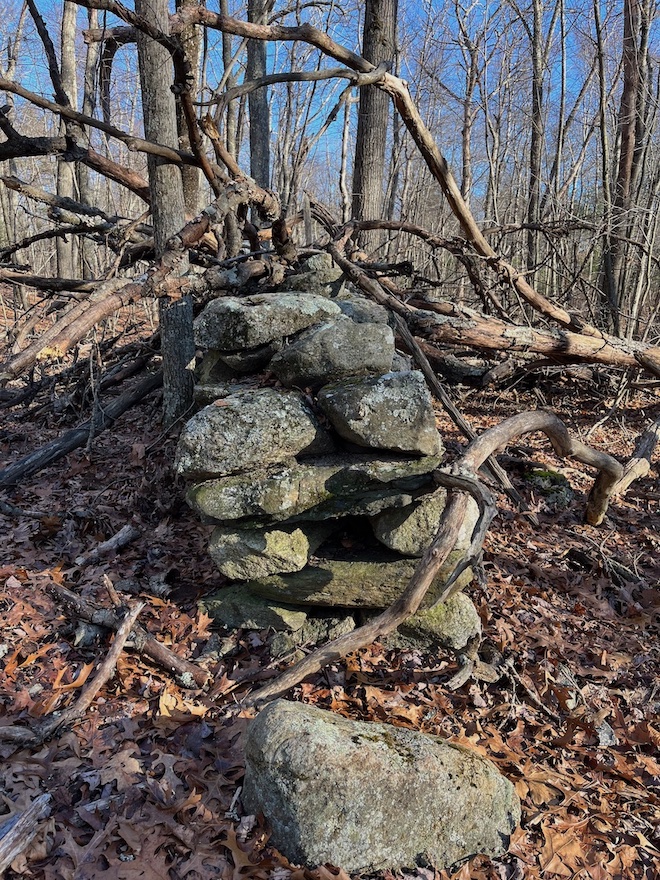
I put a blue pin at the location of a large effigy or stone pile. Some might call it a snake effigy, but it seems rather short and fat to be a snake. Perhaps we should call it The Parker Beast. Below is a picture of The Beast.
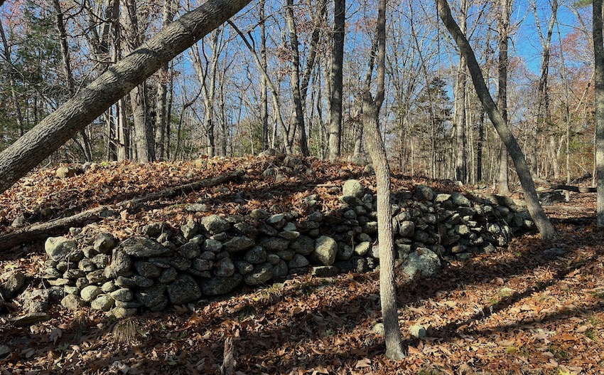
Below is another picture of The Beast, showing how it curves. There’s a chunk of quartz at the top of The Beast.
How did I find The Beast? My eye was caught by what appeared to be a stone row, not far from the trail. I began looking at what seemed to be manitou stones in the stone row. As my glance travelled further, lo! A beast!
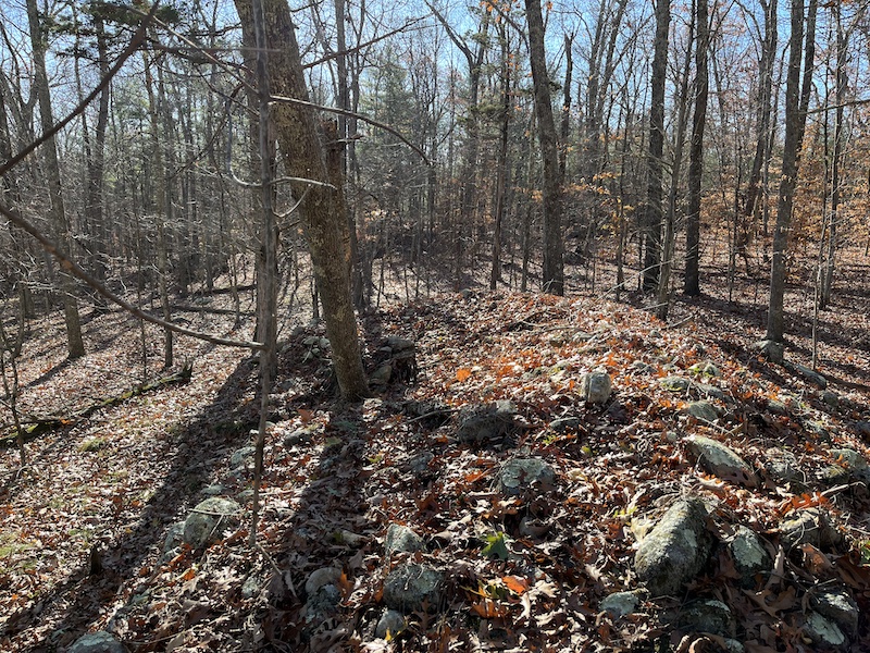
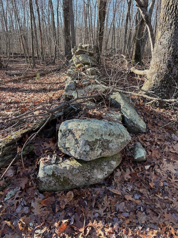
The Beast isn’t the only large mound in Parker. I put a green pin on what appears to be a large mound, somewhat shorter and straighter than The Beast.
Below is a picture of a gap in a stone row. Indian stone rows often have such gaps or entrances. If you go through the entrance, you’ll find numerous stone piles. I marked the location of this gap with a black pin.
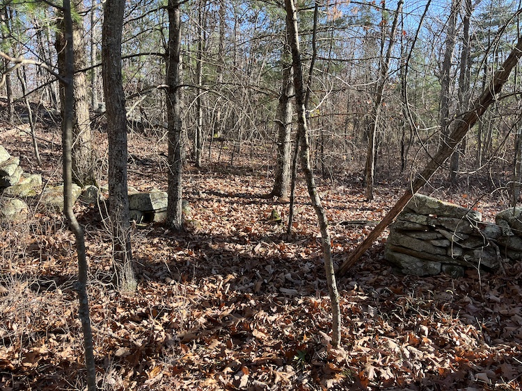
Let’s assume I’m right, let’s assume that the picture above shows an Indian stone row, not a European stone wall. And let’s assume that the gap in the stone row is also Indian-made. I would inspect the termini of the stone row, that is, the places where the row terminates; a gap has two termini, right and left. Indians often used particular art to terminate a row, as I said in an earlier issue. And you may want to inspect the row itself, looking for manitou stones, hollows, and other features of Indian stonework.
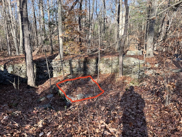
Below is the foundation of an old house, I marked its location with a house icon.
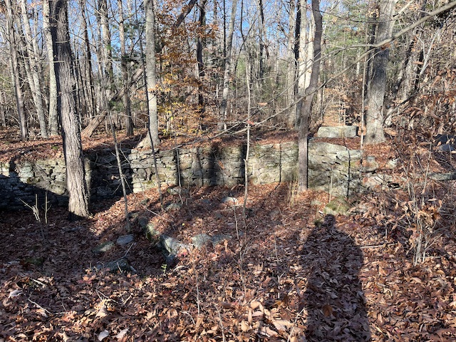
Below is the same picture with red lines marking the hearth (chimney foundation). If this is indeed the hearth, where’s the chimney?
Ken Weber says there’s a “stone-lined well” near the foundation.
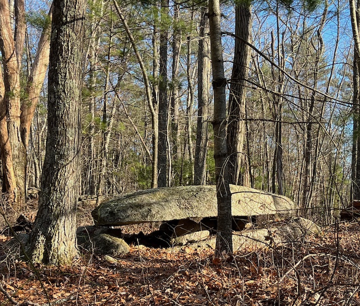
Below is a picture of a long, flat rock projecting from a cliff. It doesn’t seem natural, I suspect it’s Indian-made. One might compare it to a diving-board, projecting over a pool, or one might compare it to a standing stone in a horizontal position. I marked the location of this “diving-board” with a red pin.
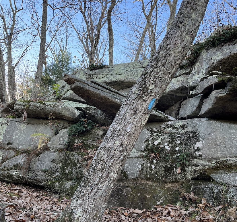
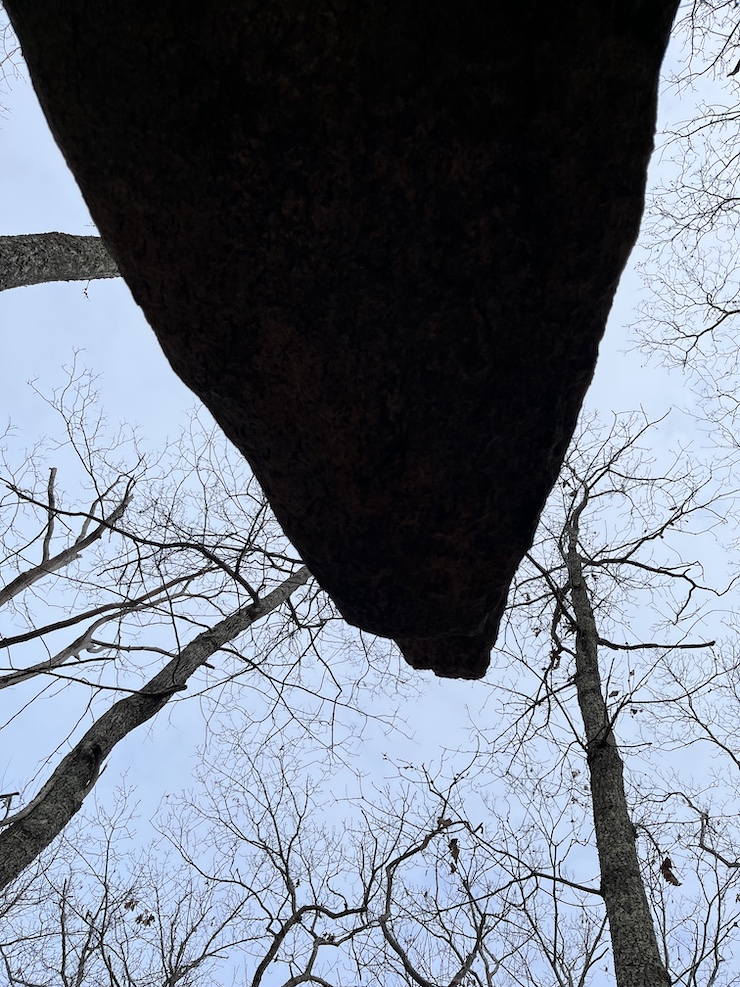
The shape of the “diving-board” might be called the manitou shape — slender at the end, broader in the middle, like the human body. Below is a picture of the “diving-board” from below:
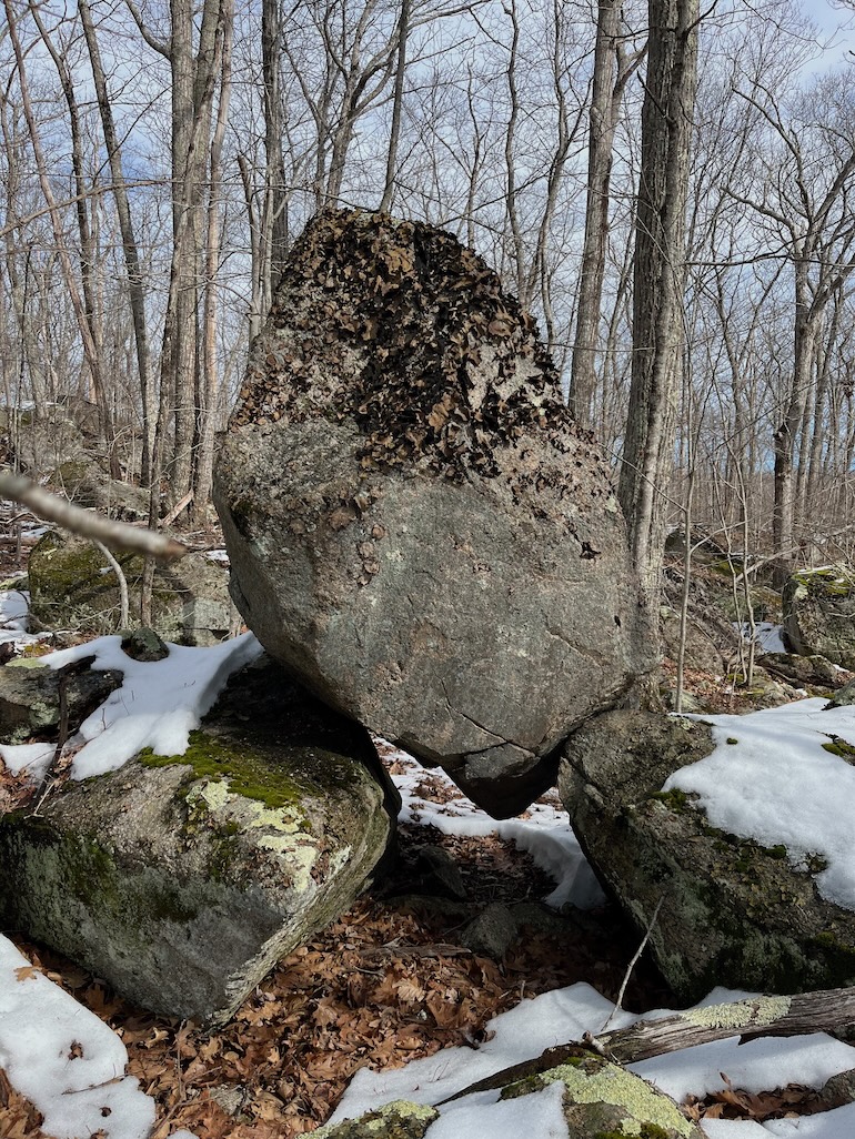
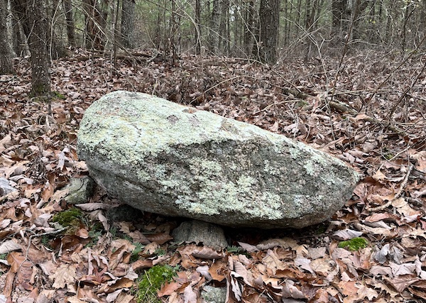
I put a yellow pin at the site of a giant erratic boulder. This is where the Blue Loop (the main trail) intersects the Yellow trail, which goes north along Pine Swamp Brook, taking you from the Coventry section of Parker to the Foster section. Ken Weber recommends following the Yellow trail until you reach a bridge over the brook; he says, “it is worth walking because it runs through a spectacular little ravine.”
I wouldn’t call the ravine “spectacular,” but there are some interesting stones. The Yellow trail is rough and rocky. Initially it’s above the cliff, and above the stream, then later it goes along the base of the cliff. Just before you reach the bridge, there are two “diving-board” rocks coming out of the cliff. I have no doubt that they’re natural, not Indian-made. Could they have inspired the Indian who made the other “diving-board”? Nature inspires art, nature was the first artist. Doubtless nature made the first standing stone, the first manitou stone, etc.
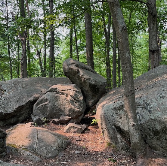
A short bushwhack will bring you to some balanced boulders, I marked the spot with a blue hiker icon. Below is one of these balanced boulders:
Below is a similar balanced/wedged boulder from Lincoln Woods State Park. It, too, has an upward-pointing shape, manitou shape.
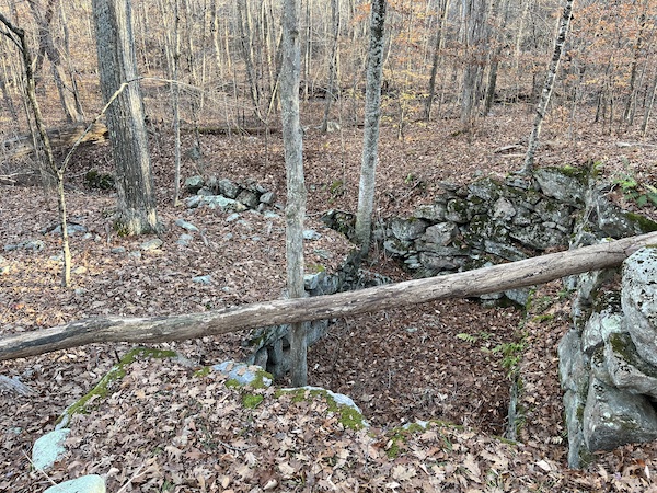
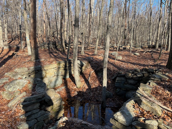
Parker Woodland once had a mill, mill-dam, mill-race, and mill-pond. Below is the cavity where the mill-wheel was located (or where its axle was located); I marked the spot with a brown pin. The wheel was turned by water flowing through the mill-race. You can see the channel of the mill-race to the right and left of this cavity (Weber calls it a “sluiceway” rather than a mill-race). And you can probably see the remains of the dam to the right of this cavity. The mill-pond was upstream of the mill-dam. Weber calls the stream “Turkey Meadow Brook,” Google Maps calls it “Flat River.”
There are many erratic boulders in Parker; indeed, there are entire fields of boulders. This may explain why there are so many Indian stones. Fertile farmland seems to have relatively few Indian stones — for example, Concord Massachusetts, near the Concord River. But areas that are hillier and rockier, such as Acton Massachusetts, or Parker Woodland, seem to have more Indian stones. (Peter Waksman makes this point in a video about Indian stones.)
When you see an Indian stone pile, how do you know it isn’t a pile made by a white farmer, a farmer clearing stones from his field? As Waksman says, an Indian pile is usually composed of stones that are roughly the same size, while a farmer’s pile has stones of different sizes. Furthermore, an Indian pile has a distinct form, while a farmer’s pile is formless and haphazard. And lastly, Indian piles are often built on outcrops of rock, while farmers wouldn’t arrange stones on top of outcrops. All things considered, it’s quite easy to distinguish an Indian stone pile from a farmer’s pile.
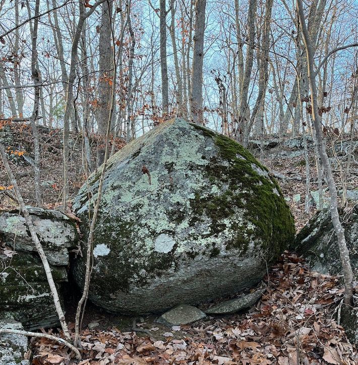
Below is a Balanced Rock; a large rock is supported by a much smaller rock. On my map, I’ve marked this Balanced Rock with a purple pin. There are several Balanced Rocks at Parker. In the picture below, the large rock has a manitou shape, an upward-pointing shape, after it’s propped-up; indeed, it may have been propped-up to give it that shape.
Below is another Balanced Rock (I marked its location with a grey pin). Again the top rock is propped-up by a much smaller rock; again the top rock has an upward-pointing shape, after it’s propped-up. Was it made by the same person who made the other Balanced Rock?
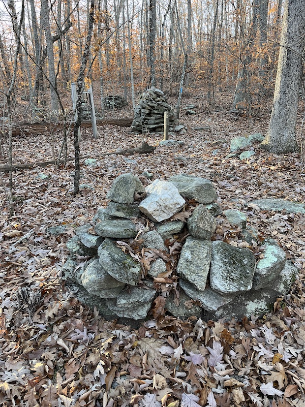
Below are some of the cairns that Parker is known for. These cairns are stone mounds with a cone shape. The cairn in the foreground has a piece of quartz on its top.
Below is a longer walk (5 miles) in Parker Woodland. It’s not a complete tour of the Parker trails; a complete tour might be 7 miles.
The Parker trail system has a southwest loop and a northeast loop. The above route starts in the southwest, crosses into the northeast (i.e., crosses Pine Swamp Brook), visits “Table Rock,” then leaves the trail and takes a dirt road (Pig Hill Road, sometimes called “Thomas Parker Road”). It follows Pig Hill Road south to Maple Valley Road, then goes west to the parking lot. Pig Hill Road starts as a dirt road (suitable only for hikers and mountain-bikers), then becomes a paved road. You could park at the northern end of the paved section of Pig Hill Road, then take the northeast loop — a hike of 2.5 miles.
Below is a “prayer seat,” I marked its location with a blue pin. I never saw a prayer seat with such good arm-rests!

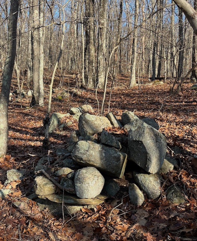
Below is a stone pile, I marked its location with a green pin. As with other stone piles, I would ask, Is this a turtle effigy? Does it have any manitou stones (i.e., upward-pointing stones)? Does it have a niche (i.e., a hollow space where an offering could be placed)?
Below is a stone pile (foreground) and a stone row (background), I marked the location with a yellow pin.

Below is an old foundation, which I marked on the map with a black pin. Note the massive central hearth, and the beautifully curved front step.
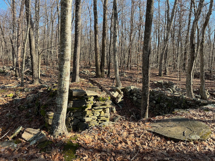
Below is a smaller foundation, with neither hearth nor front step. Perhaps it’s for a barn? I marked the location with a purple pin.
When I took the picture below, I was standing in a gap in a stone row, looking at the two termini (the two sides of the gap). I marked the location with a red pin. The picture below shows one terminus, one side of the gap. Note the niche or aperture.
When I turn around, I see the other side of the gap, the other terminus (picture below). This side of the gap has a manitou stone, a stone pointing toward the gap. This is typical of stone-row termini.
Below is a dolmen known as “Table Rock” (I marked its location with a brown pin). One might compare it to the Foxboro Dolmen. There’s a short, dead-end trail leading to Table Rock; after visiting Table Rock, you can retrace your steps to the main trail, or bushwhack to Pig Hill Road (as I did).
Below is a route in the northeast section of Parker Woodland. I put red pins on two quarries. I parked on Pig Hill Road, where the pavement ends and the dirt road/trail begins.
Below is a picture of the more northern quarry. Water often collects in quarries since the land is low, the land has been “hollowed out.”
