Newport is known for its Gilded Age mansions, its colonial-era streets, its beaches, its old synagogue, and its religious toleration, which made it a haven for Quakers, Jews, Anglicans, etc. One of Newport’s gems is Trinity Church, an Episcopal church that was built in 1725. “In the mid-18th century, the church was home to the largest Anglican congregation in New England.”(Wikipedia) Another Newport gem is the Quaker Meeting House, known as “Great Friends Meeting House.” “The meeting house is the oldest surviving house of worship in Rhode Island.... Upon its completion in 1699, the meeting house was the largest structure of any kind between Boston and New York.”(Wikipedia) Click here for information about guided tours of Newport, and here for info about biking in the Newport area.
Newport’s Cliff Walk (3.5 miles) offers views of mansions, ocean, and cliffs. On a hot day, the little bays and beaches are inviting; you may wish you had a bathing-suit, and a mask-and-snorkel. From the northern half of the Cliff Walk, you can usually see Sakonnet Light to the east, a gleaming white lighthouse at the southern end of Little Compton. Bird-watchers will enjoy the ducks, especially in the winter. Winter is the best season for the Cliff Walk; it’s crowded in the summer.
On the northern half of the Cliff Walk, you’ll see lots of basalt, a black rock, while the southern half has lots of granite, often with quartz veins. The southern half of the Cliff Walk is quite rough. If you park on Wetmore Ave. or Ruggles Ave., you can divide the Cliff Walk into two parts. North of Ruggles Ave., the trail is smooth and the walking is easy.
As you follow the Cliff Walk, you may hear massive waves pounding against million-year-old cliffs; the deep tones are impressive, a memorable example of the power of nature. Or, when you pass one of the little beaches, you may hear the gravel rolling back as each wave recedes.

Evening on Newport’s Cliff Walk

|
| Newport Map The blue line is Bellevue Avenue, where you’ll find GildedAge mansions. The red circle is a neighborhood with older houses, colonial houses. The yellow circle is “The Point,” a neighborhood with old houses, less commercial and less busy than the “red neighborhood.” |

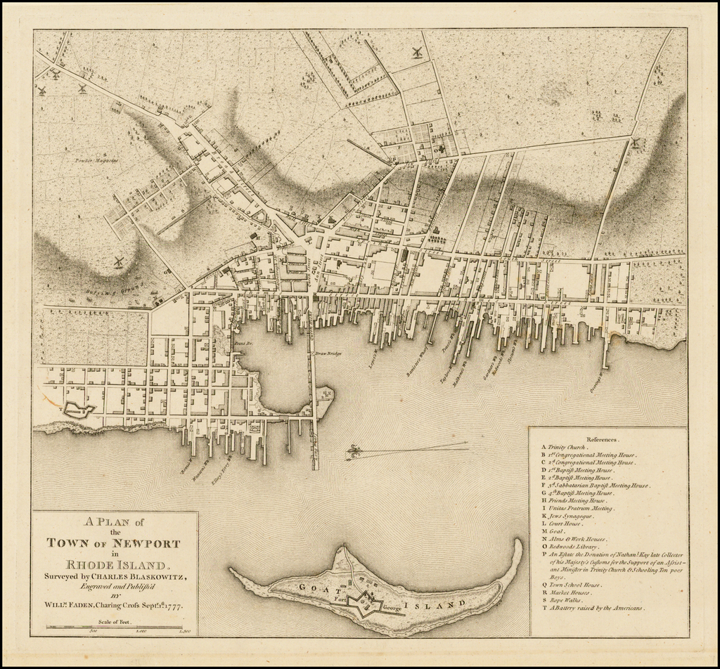
1777 Map of Newport
“The Point,” is in the lower left,
in the center-right is Newport’s historic core,
with Thames Street and Spring Street
Below is a 7-mile loop that includes the Cliff Walk and Bellevue Avenue.
Like Newport, Providence was a haven for dissenters, a haven for those who clashed with the Massachusetts Bay establishment. Providence was founded in 1636 by a dissenter, Roger Williams, who got along well with the Indians. In 1642, a settlement on the west side of Narragansett Bay, in what is now Warwick, was started. The Boston authorities were angry, believing that these heretics were occupying their land. So they sent an armed force from Boston to arrest them. Most of the Warwick men were sentenced to hard labor, with iron balls on their limbs (they were released after four months). Their houses were burned “and their women and children forced to flee in canoes to the neighboring islands for safety.”1 This episode shows how intent the Boston authorities were on stamping out dissent and “heresy.” The early history of New England contains numerous episodes in which freedom of religion wasn’t allowed.
Like Providence and Newport, Nantucket was a haven for dissenters. Some of Nantucket’s earliest settlers were Quakers, or people accused of harboring Quakers. (John Greenleaf Whittier wrote a poem about Nantucket settlers called “The Exiles.”) One might say that, in general, people who ran afoul of the Boston authorities took refuge in peripheral areas.
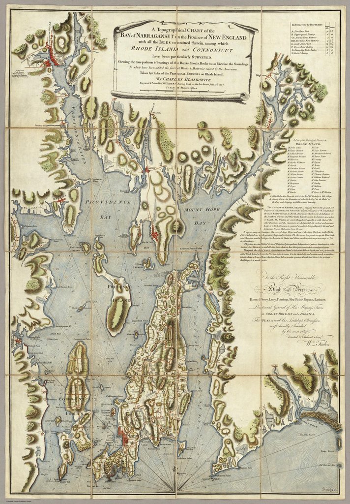
“Why is Rhode Island called ‘Rhode Island’? After all, it isn’t an island, is it?” Rhode Island was originally the name given to Aquidneck Island, the largest island in Narragansett Bay. Aquidneck Island was the location of some of the state’s earliest settlements, and is now the location of Newport, Middletown, and Portsmouth. If you drive to Aquidneck Island from the west, you go over a major bridge, the Newport Bridge, but if you drive from the east, you go over a small bridge, since the island is close to the mainland; approaching the island from the east, you may not feel that you’re on an island. Another early settlement in Rhode Island was at Providence. So the state was originally called “Rhode Island and Providence Plantations,” and that’s still the official name.

1777 Map of Narragansett Bay
Newport was a flourishing commercial hub in the 1700’s, but was occupied by the British during the American Revolution, halting trade and causing economic decline. One reason for its prosperity was that it had Jews from Spain/Portugal, such as Aaron Lopez, who had business contacts around the world. Lopez was by far the wealthiest person in Newport, and one of the most successful merchants in the American colonies.
One way to reach Newport is by ferry. The Jamestown Newport Ferry stops at several places in Narragansett Bay. You can disembark, explore the area, then board the next ferry.
Just north of Newport, in the “middle” of Aquidneck Island, is Middletown, where you can visit the home of philosopher George Berkeley, who came to Rhode Island with the intention of starting a university. This plan didn’t come to fruition, but Berkeley did organize a discussion group. If you visit the Norman Bird Sanctuary in Middletown, you can walk to the end of Hanging Rock Trail, and enjoy a view of the Newport beaches, St. George’s School, etc. Be prepared for rough terrain.
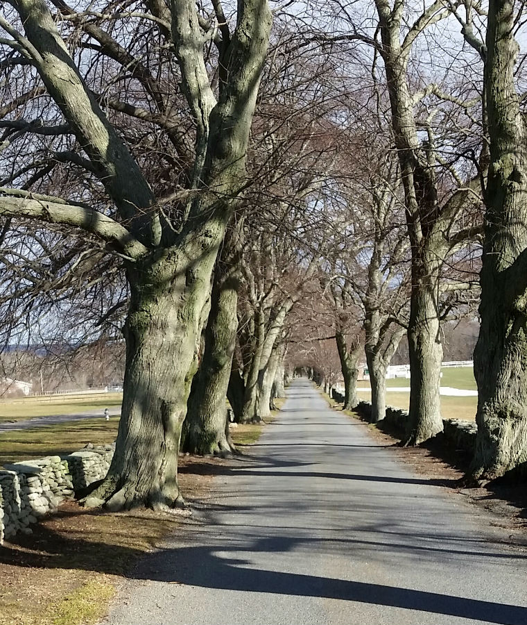
North of Middletown is Portsmouth, Rhode Island, which has an attractive polo field, and several trails that are managed by the Aquidneck Island Land Trust. Below is a 7-mile walk in Portsmouth, on the Sakonnet Greenway. And below the map is a picture of Linden Lane, where the walk starts.

Linden Lane is lined with old stone walls and old linden trees.
Below is a 12-mile loop. I parked at the south end — the soccer fields on Wyatt Road. Then I cycled north along Wapping Road, and Glen Farm Road, to the playing fields at Glen Park, and left my bike.
Then I walked through Glen Manor House to the Sakonnet River (Glen Manor House is private property, so this isn’t a route to be taken frequently). Then I followed the shoreline south to Sandy Point Beach; this walk is best at low tide, not sure if it’s possible at high tide. You’ll have a good view of the Sakonnet River; High Hill Point Lighthouse is across the River from Sandy Point Beach (this lighthouse isn’t a real lighthouse, it just looks like a lighthouse; and the Sakonnet River isn’t a real river, it’s a “tidal strait”).
Then I followed Sandy Point Avenue west, and began walking the Sakonnet Greenway south (I put a yellow pin on a charming bench in a meadow). Then I continued along the Greenway as it skirts a golf course (the golf section of the Greenway is a bit dull compared to the “natural” sections). The “golf path” brings you out on Mitchell’s Lane. The trail from here to my parking-spot is closed as of September 2024 (apparently the golf club is expanding).
© L. James Hammond 2023
feedback
visit home page
make a donation via PayPal
| Footnotes | |
| 1. | “Stukeley Westcote,” Narragansett Historical Register, July 1886, Vol. V, #1. Wikipedia speaks only of a “tense standoff,” followed by the arrest of several Warwick settlers. In 1663, Charles II issued a royal charter to Providence Plantations, “to hold forth a lively experiment, that a most flourishing civil state may stand and best be maintained... with a full liberty in religious concernments.”
Roger Williams made a dictionary of the Indian language. Another early settler, John Eliot, also studied the Indian language, and translated the Bible into the Indian language.
If you’re interested in Rhode Island history, consider Sons of Providence: The Brown Brothers, the Slave Trade, and the American Revolution, by Charles Rappleye, and Grappling with Legacy: Rhode Island’s Brown Family and the American Philanthropic Impulse, by Sylvia Brown. back |