Arcadia Management Area is in southwest Rhode Island, and is the state’s largest open space — 14,000 acres.
Below is a 6.5-mile circle that starts at Breakheart Pond, where there’s a parking lot. I walked counter-clockwise, starting on the Breakheart Trail, then going to Penny Hill. You can skip Penny Hill, and take Shelter Trail. You can walk on either side of Breakheart Pond (if you want a short walk, you can circle Breakheart Pond). I put a black pin on the west side of the pond, to mark a large foundation; I used another black pin to mark another old foundation. I used blue pins to mark propped boulders.
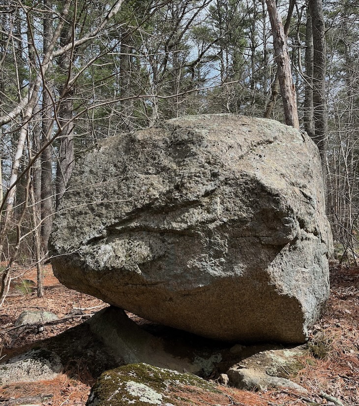
Below is a propped boulder. On the above map, it’s just south of my starting point, near a brook, and near the pond.
Below is a 5.5-mile route that crosses the Wood River, the Flat River, Parris Brook, etc. It also climbs Mount Tom, and has some good views. The trail is well marked. It starts just south of Route 165 (Ten Rod Road); you’ll see a sign on Route 165 that says “Arcadia Check Station and Canoe Launch.” A similar walk can be found in Ken Weber’s Walks and Rambles in Rhode Island.
The route below is about 6 miles long. It starts at the same parking-lot as the previous walk. If you walk counter-clockwise, you’ll start on the Mount Tom Trail, then cross Route 165 and take the J. B. Hudson Trail, then follow Breakheart Brook to Breakheart Pond, then walk along the west side of Breakheart Brook to Frosty Hollow Road, then take the Deion Trail.
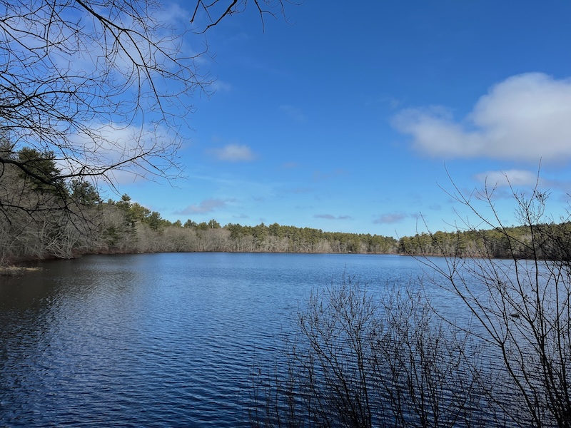
Breakheart Pond
Below is the Ben Utter Trail, which follows the Wood River northwest to Stepstone Falls. This route is about 3 miles round-trip.
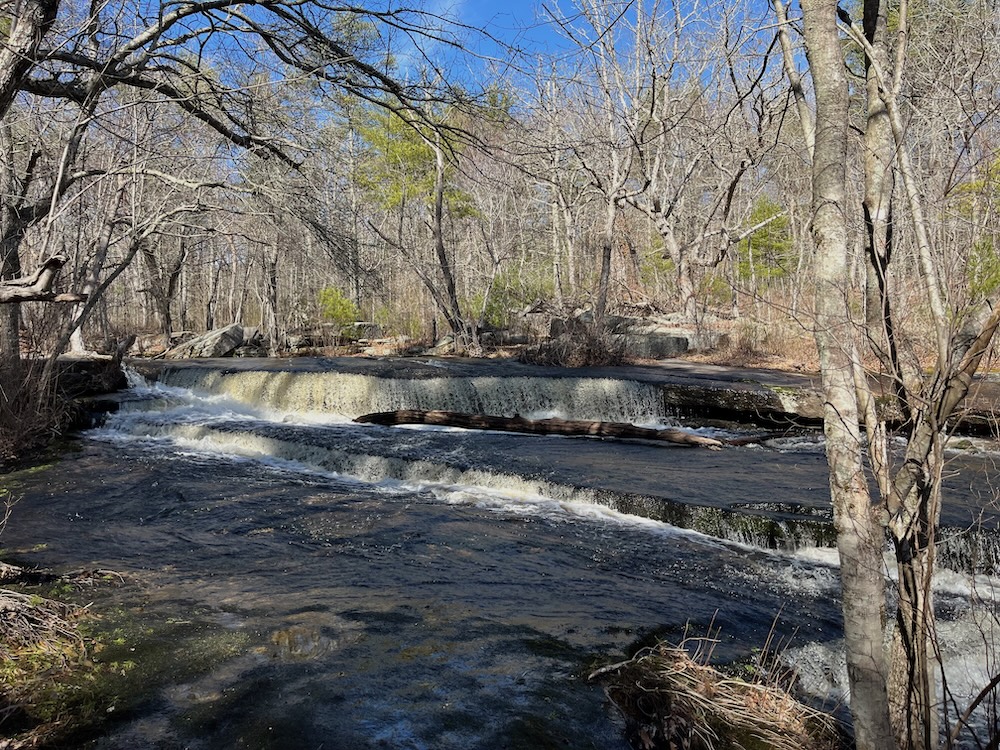
Stepstone Falls
Stepstone Falls are partly natural, partly the result of quarrying. In the above picture, blocks of quarried stone are on the far side of the river; these blocks were cut and removed, but never used.
The Ben Utter Trail is rocky, but not steep. It passes several old mills. It’s a woodsy trail — you won’t get a sunburn.
To reach the trailhead, you can turn north off Route 165 onto Frosty Hollow Road. Drive 1.5 miles north on Frosty Hollow Road (it may change its name to Camp E-Hun-Tee). At the T intersection, turn left on Plain Road. Drive 2.1 miles to a bridge over the Wood River (you’ll pass a bridge over the Flat River). Park just beyond the bridge. You’ll see the trail on the right side of the road. (Both Frosty Hollow Road and Plain Road are dirt roads, and they’re often rough.)
When I visited on March 22, 2025, I couldn’t drive down Plain Road, it was blocked by a gate. So I walked 2 miles along Plain Road, to reach the BenUtter Trailhead. Perhaps Plain Road is blocked until April 1.
The BenUtter Trailhead is in Exeter RI, but the trail is almost entirely in West Greenwich RI. I encountered several people on the trail, and at the falls. It must be possible to drive to the trail and the falls from the other side, instead of from Route 165. The Ben Utter Trail overlaps with the North-South Trail, which runs for 77 miles through western Rhode Island, and connects with the Mid-State Trail in Massachusetts. Below is a map of the North-South Trail.
The Wood River is the “parent river” for many smaller streams in this area. The Wood River flows south for about 15 miles, and joins the Pawcatuck River at the junction of three RhodeIsland towns: Hopkinton, Richmond, and Charlestown. Then the Pawcatuck flows to the ocean (for its final 10-15 miles, the Pawcatuck is the border of Rhode Island and Connecticut).
Below is a 7-9 mile route called Arcadia Trail. It’s a one-way trail, not a loop. You can return to your starting point via bike or second car or Uber.
Below is the same map, showing the “full loop” (bike route and hiking route). The bike ride is rather unpleasant — giant trucks flying by you at high speed. An Uber would be easy; the roads are paved, unlike the roads in “Arcadia north.”
I parked at Appie Crossing on Route 165, then cycled to the park headquarters on Arcadia Road (Ken Weber calls it Summit Road). The trail starts at the green pin, which is across the street from park headquarters. I hiked east then northwest to return to Appie Crossing. I made one wrong turn (marked with a black pin), which added 1/2 mile to the route. If you hike in the opposite direction (starting at Appie Crossing and hiking southeast), these trail notes might be useful.
I was hiking on April 14, 2025. One of the highlights of the trail are the streams, which were flowing swiftly since there had been recent rain. Several bridges were built to help hikers cross the streams. The first section of the hike is a pine forest, I heard lots of pine warblers (the app Merlin can help to identify bird songs). There were lots of blow-downs (trees knocked over by wind). It was a warm day, and bugs were apparent, but not a problem.
I put a yellow pin on an old foundation, perhaps a barn foundation. I put a brown pin on a stone bridge. Ken Weber says that, at the bridge, there’s a “small man-made pond.” The pond seems to have filled in, but you can see some concrete that may have created a dam. Was the dam intended to form a pond? Or play a role in a mill? Ken says that, “a few yards” before the stone bridge is “a small cellar hole.” Google Maps says that the stone bridge is at Baker Brook, which seems to flow west to the Wood River. The Arcadia Trail crosses Baker Brook when it’s heading south, then again when it’s heading north.
As the day wore on, I saw lots of NativeAmerican stone-work. Also lots of erratic boulders, sometimes so dense as to make walking difficult — a “boulder field.” There’s some highway noise, but it’s not a problem. I was able to get cell-phone reception throughout the hike. You can shorten the trail by taking what All Trails calls “Arcadia White Trail.”
The description of Arcadia Trail in Ken Weber’s Walks and Rambles in Rhode Island is still valid, though it’s 30-40 years old. At my red pin, there’s a small mill pond, a good place to rest. Ken Weber says that there’s a beaver lodge on the left side of the pond (west side), but now there’s a beaver lodge on the right side.
Below is another route in the southern part of Arcadia (south of Route 165); this route is 7 miles long. As with the previous route, I parked at Appie Crossing, where there’s space for at least 4 cars. This route seems better for bikers than hikers, but it does give you some familiarity with the area. I wanted to walk along the edge of the pond, rather than on Arcadia Road, but signs said, “Hatchery Closed, No Admission.” Just east of Browning Mill Pond there’s a nice bridge, a boardwalk, and the vestiges of a mill.
On the above map, I used a yellow pin to mark a large erratic, a green pin to mark a cistern (probably for fire-fighting), a brown pin to mark an old foundation (cellar hole), and a red pin to mark an area that has stone piles (made by Native Americans). I put a blue pin on a small NativeAmerican grinding stone (picture below). The stone is on the grounds of Tomaquag Museum, near a bench. The stone is evidently intended to be used by someone who’s sitting or kneeling.

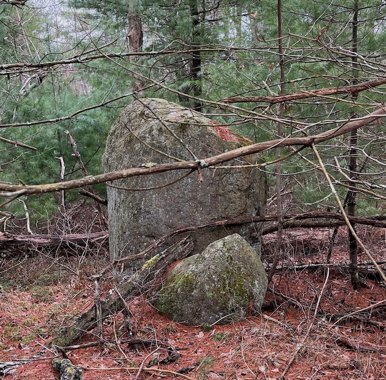
Below is a pair of rocks that form a balanced arrangement, the smaller rock “high right,” the bigger rock “high left.” It’s hard for me to believe that this balanced arrangement is accidental. I marked the location with a black pin.
Below is a 4.5-mile route that circles Barden Reservoir in Foster, Rhode Island (part of the route is in western Scituate). This route is mostly on dirt roads, and has a few hills.
I put a “D” on the map to mark a Dam, the dam that crosses the Ponaganset River to create the reservoir. The dam was probably built around 1925 (when the Scituate Reservoir was created by damming the north branch of the Pawtuxet River). Near the dam you’ll see an old mill race, which is probably 100 years older than the dam (a mill race channels water into a mill).
I put a “C” on the map to mark a small bridge that has been Closed (closed to cars, but probably safe for walkers).
You may want to combine this walk with a visit to Foster Center (marked with an “F” on the map). Foster Center has an old town hall, an old jail, etc.