If you’re driving through western Massachusetts on I-90, you may want to leave the highway to see some Berkshire towns. If you’re driving west, you can leave the highway at Exit 10 (formerly Exit 2) in the town of Lee, which is on the Housatonic River. Then follow the river west on Route 102 to Stockbridge (there’s a trail in Stockbridge called Laura’s Tower, and an adjacent trail called Ice Glen). Then continue on Route 102 to West Stockbridge, or take Route 7 north toward Lenox, or take Route 7 south to Monument Mountain in Great Barrington. (West Stockbridge is on the Williams River, a tributary of the Housatonic.) Eventually you can get back on the highway at Exit 3 (formerly Exit 1) in West Stockbridge.
Below is a map of the Laura’s Tower trail. It’s one mile (two miles round-trip). The elevation gain is about 650 feet; it’s a rather steep trail. Mt. Greylock is plainly visible from the tower at the summit, unless it’s a cloudy day.
From Laura’s Tower, Mt. Greylock looks like a saddle, with multiple peaks.
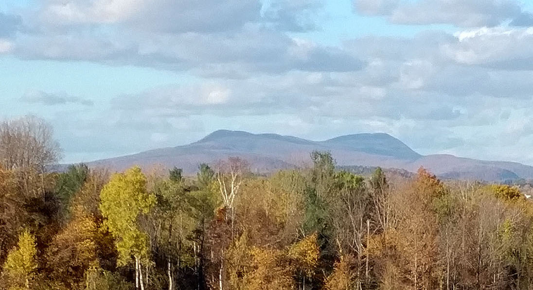
In Thoreau’s day, Mt. Greylock was called “Saddle-back Mountain,” and a peak southwest of Greylock is still called “Saddle-ball Mountain” (Saddle-ball Mountain is only 250 feet shorter than Greylock).
In the above picture, Greylock is on the right; if you climb Laura’s Tower, and use binoculars, you can see a tower on the summit of Greylock. The peak on the left is probably Saddle-ball Mountain.
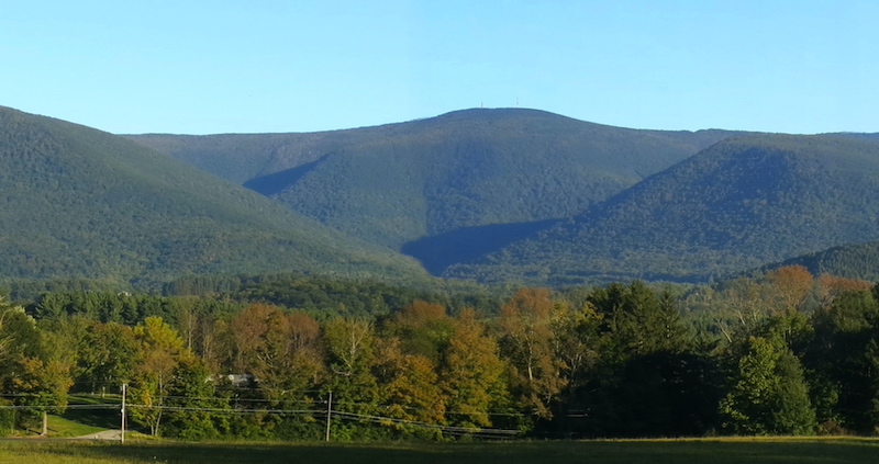
Mountains look different from different sides. From Adams MA, east of Greylock, Greylock appears to be a single peak, not multiple peaks:

If you look closely at the above picture, you may notice the tower on the summit.
If you view Greylock from the west, you see the “hopper” or “cirque,” a hollow carved out by the glacier:
Since Williams College is west of Greylock, students from Williams often follow the Hopper Trail to Greylock’s summit. When Thoreau climbed Greylock in the summer of 1844, he approached from the east, and followed the Bellows Pipe Trail.
When I climbed Greylock around 1990, I probably followed the Appalachian Trail, approaching the summit from the south, ascending parallel with the paved road known as Rockwell Road, then descending via Rockwell Road.
Below is a map of the Ice Glen trail. I circled back to the parking lot, but the circle isn’t scenic, so you should probably retrace your steps through the Glen.
I don’t think ice will be a problem in Ice Glen, unless there’s been snow/rain/cold recently. It’s a charming trail, with stairs made by volunteers (the Laura’s Tower trail is also well-maintained). It’s a good example of what was called, around 1850, the sublime. The circle route is 2 miles; if you walk through the glen, then retrace your steps, the route is 1.5 miles round-trip. It’s a rather flat trail (200 feet elevation gain). Since the footing is rough, trekking poles are recommended.
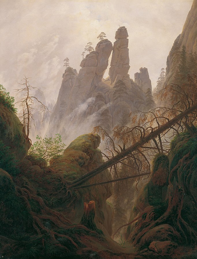
In my essay on the sublime, I included a painting by Caspar David Friedrich, whom I called the “leading representative” in Germany of the Romantic Sublime. The painting depicts the sort of rough, rocky land that you find at Ice Glen
Below is a picture that I took in Ice Glen in December.
According to the IceGlen website, “At the south end of the glen is reputedly the tallest pine in Massachusetts.” I’m not sure if I saw this pine, so I can’t help you find it.
“Ice Glen” is a chasm, sometimes called a “purgatory” or ravine or glen. The word “Ice” comes from the ice and snow that was once found in the chasm, even in summer, before the advent of global warming. Since the sun doesn’t enter chasms, they kept their ice and snow during the warm part of the year.
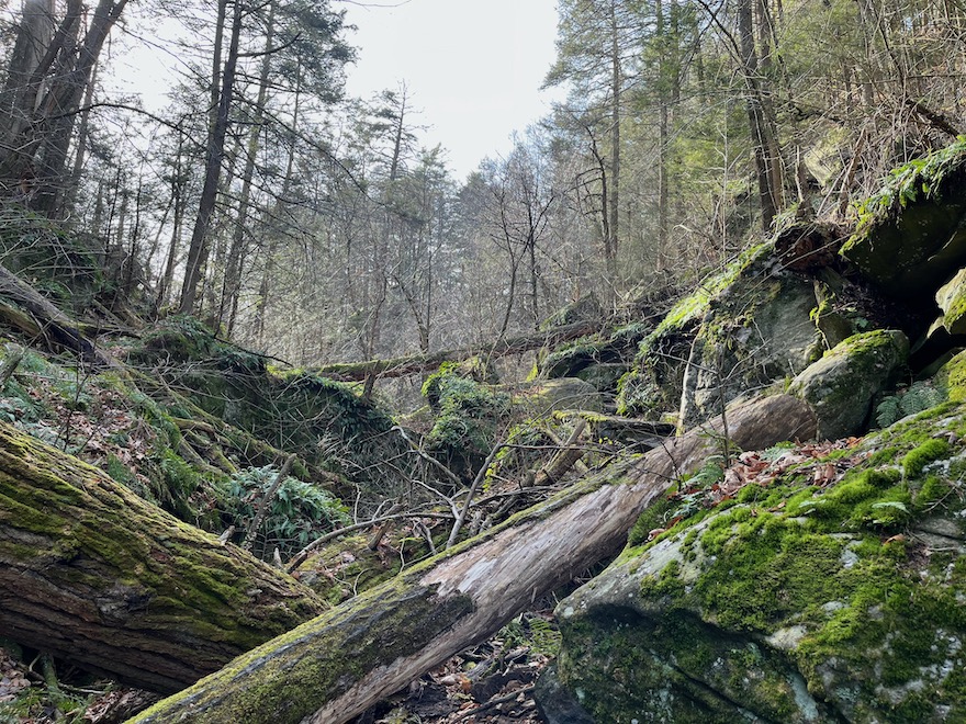
About 7 miles south of Ice Glen is another chasm, sometimes called the GreatBarrington chasm. Below is a one-mile route to the GreatBarrington chasm (two miles round-trip). The route follows the Appalachian Trail, and starts from an AppalachianTrail parking lot. You’ll gain 460 feet of elevation. The chasm is near the end of this route.
You don’t walk through the bottom of the chasm (the bottom is covered with boulders, and would be difficult walking). You walk on the edge of the chasm (it will be on your left as you climb up). If some trees were cut, there would be a good view at the southern end of the chasm.
In New England, a chasm is sometimes called a “purgatory,” since early settlers thought of chasms as gateways to purgatory/hell. Click here for my remarks on Tophet’s Chasm in Littleton MA. On the map below, the red line is the Appalachian Trail, and the chasm is between the black lines that I made.
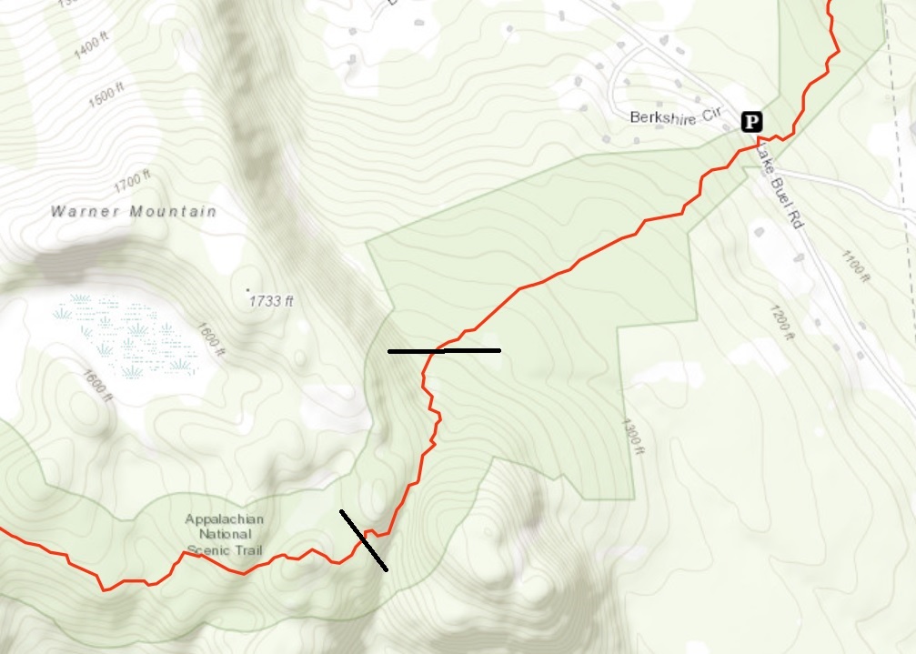
Note that there’s a parking area on Lake Buel Road. Click here to open the parking area in Google Maps. Or you can search for 110 Lake Buel Road, Great Barrington.
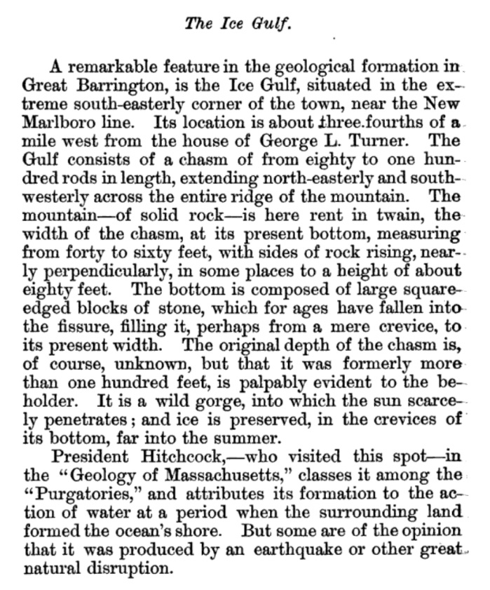
Edward Hitchcock says that the GreatBarrington purgatory resembles Purgatory Chasm in Sutton MA:
|
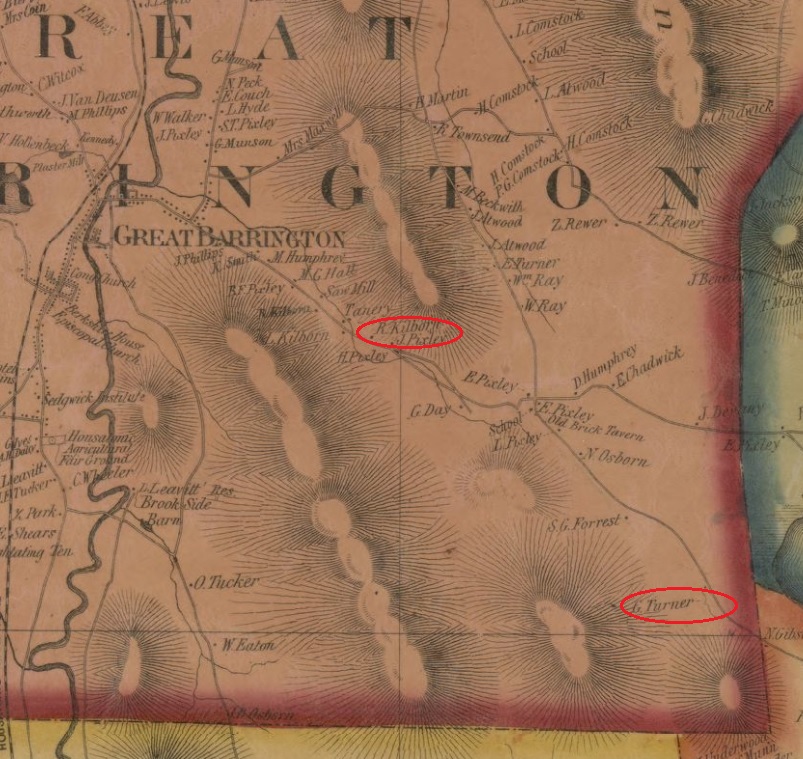
A fissure very similar to that in Sutton, exists in the mountain east of the village of Great Barrington. The best way to reach it, is to pass around the north end of the mountain, and then to go southerly a mile or two, as far as the house of Russell Kilbourn: from whence a walk of three quarters of a mile will lead to the spot. It is an open fissure, about 4 rods wide, with perpendicular walls, which in some places rise to the height of 80 feet. The bottom in most parts is strewed over with loose but not rounded blocks, which were obviously derived from the sides. This detritus frequently fills up the bottom several feet; so that probably the entire depth cannot be much less than 100 feet. Among the loose masses of rock, snow and ice frequently remain through the summer. I found them there in abundance on the 25th of June in a very sultry day.
This Purgatory is in gneiss, which a good deal resembles that in Sutton. The strata in Great Barrington are nearly horizontal: and the fissure is nearly straight; but at its western extremity, the sides rather diverge. It runs S 25 W and N 25 E and extends across the entire ridge of the mountain, at least 80 rods in length [a rod is about 5 meters, 80 rods is about 1/4 mile]. Its bottom cannot be less I think than 800 feet above the bed of the Housatonic. |
Another author, Charles James Taylor, discusses the GreatBarrington chasm in his History of Great Barrington. This is clearly the same chasm Hitchcock discusses in the quotation above. Taylor refers to Hitchcock as “President Hitchcock” since Hitchcock was the President of Amherst College.
The above quotations refer to the Kilbourn house and the Turner house. I’ve marked those houses on the map below, which was made by Henry Francis Walling, and published in 1858 (click here for complete map, which covers all of Berkshire County). This map doesn’t show the chasm, at least not in a clear, conspicuous way.