Perhaps the largest refuge in the Sharon/Easton area is Moose Hill. You can think of Moose Hill as three separate parts:
- the west side is an Audubon property with a bluff that has a broad view, a summit that has a fire tower (the summit is called “Moose Hill”), an old cistern, etc.
- the east side is also an Audubon property, and it has a kettle hole, Hobbs Hill, “The Boulders,” etc.
- the north side is owned by the Trustees of Reservations; it has an open field, a view of Boston, etc.
They say the view from the fire tower is excellent, but the tower is usually locked; you might try asking the Sharon Fire Department to unlock it. The bluff is a good spot for a picnic. The above map has some short detours where I was looking for Indian stones; I think there are some stone rows in the area.
Below is a 4-mile route that goes to King Philip’s Rock, King Philip’s Cave, and TwoStory Rock. You’ll see some amazing jumbled boulders, some of which must have been manipulated by Native Americans.
I put a blue pin on King Philip’s Cave (King Philip’s Rock is labelled on Google Maps, as is TwoStory Rock). Here’s a sign you’ll see along the route:

The sign above mentions a “tall standing stone,” but I didn’t find such a stone. On the way from King Philip’s Cave to TwoStory Rock, you’ll climb a hill (red pin on map) that may be a drumlin.
For more information about this area, visit the Sharon Friends of Conservation. Their map describes TwoStory Rock as “A big squarish boulder with another on top.” This description suggests two erratics, one on top of the other, as we see at Balance Rock, near Wachusett. In fact, TwoStory Rock is an erratic on an outcrop, not two erratics, but since the outcrop has a squarish shape, perhaps the description is okay.
Below is TwoStory Rock. If you look beneath the top boulder, you’ll notice that it only contacts the bottom rock at a couple small points, and you’ll notice that the top boulder is propped up by two very small propping stones.

The route above ends at the Power Lines. The route is in Sharon, except for the southern end (TwoStory rock and the Power Lines), which is in Foxboro.
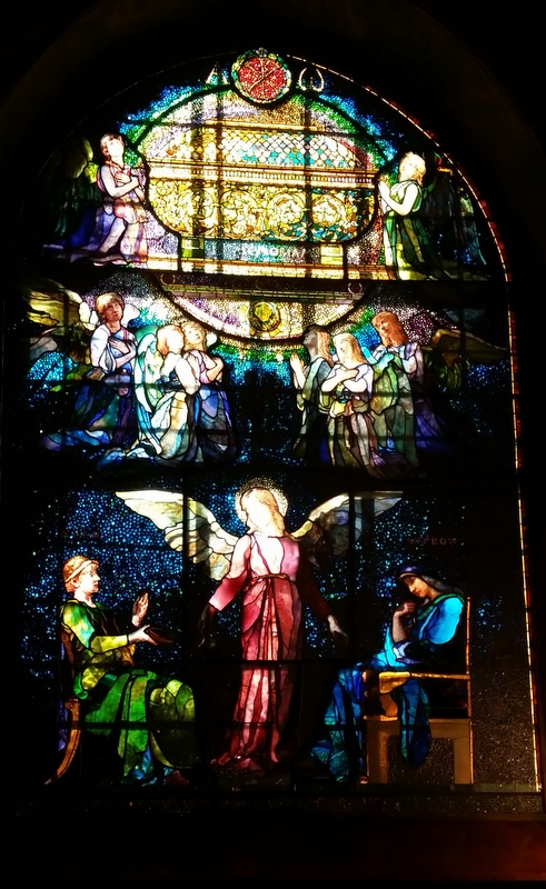
North Easton (a village within the town of Easton, Massachusetts) is about thirty miles northeast of Providence. It has several buildings designed by H. H. Richardson, and landscapes designed by Frederick Law Olmsted. Many of the buildings were financed by the Ames family, which made a fortune manufacturing shovels at their factory in North Easton. The Ames family was prominent in Massachusetts politics; one was a Governor, one a Congressman, etc. The Easton Historical Society is based in a Richardson-designed train station, and offers various programs. Near the Historical Society is the Governor Oliver Ames Estate, a spacious and scenic property managed by the Trustees of Reservations. Easton’s Unity Church contains elaborate woodwork, and stained-glass windows designed by John La Farge.

Angel of Help, stained-glass window designed by John La Farge
Unity Church, Easton, Massachusetts

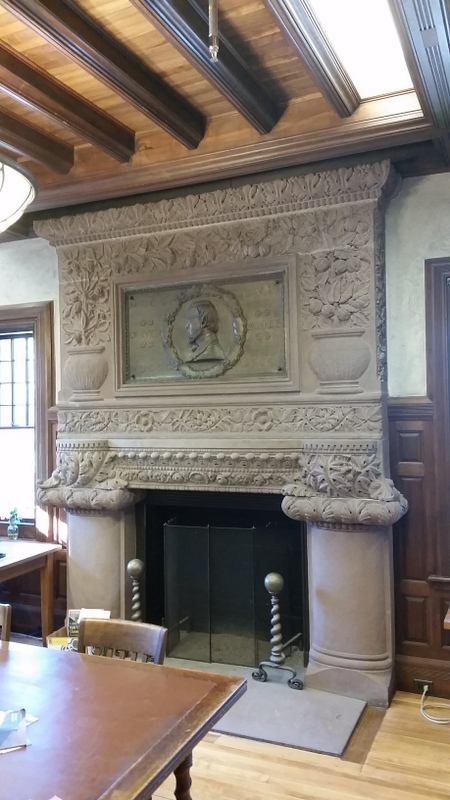
Stanford White designed this fireplace in the
Ames Free Library, Easton, Massachusetts

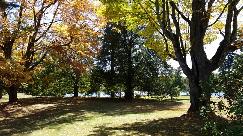
Ames Estate, Easton, Massachusetts
A couple miles east of the village of North Easton is Borderland State Park, which straddles the border between Easton and Sharon. It’s an attractive park, with old carriage roads and many miles of trails. It has a castle built in 1906 by Oakes Ames and his wife Blanche. Oakes Ames was a Harvard botanist, specializing in orchids, Blanche was an artist who made drawings of her husband’s plants. They designed the castle to be fire-proof, so their plants and drawings wouldn’t be destroyed by fire.
Oakes Ames was the son of Governor Oliver Ames. Blanche Ames was the daughter of Adelbert Ames (no relation to the Ames family of Easton), hence her name was Blanche Ames Ames. She was the granddaughter of Benjamin Butler, a Massachusetts Governor and Civil War General. She complained to John F. Kennedy about some comments that Kennedy made about her father in his book Profiles in Courage. Finally she wrote her own biography of her father, Adelbert Ames, 1835-1933. Her grandson was the American writer George Plimpton (George Ames Plimpton).

The castle at Borderland State Park

A carriage trail at Borderland
When I heard that there were NativeAmerican stone-structures at Borderland, I decided to venture away from the pond. Below is a 3-mile route northwest of the pond.
This “Northwest Territory” has lots of erratic boulders, some of them propped; it also has some stone rows, and other native structures. Below is a stone pile with manitou stone, on top of a large boulder.

Below is a large niche, or a small chamber. It’s part of a enclosure, made from stone rows and unmodified boulders; the enclosure is about 30' X 25'.

Below is a propped boulder, I marked its location with a blue pin. The propping stone is plainly visible to someone at the site, but not visible in the photo.
